Because those brown peach & infrared maps are blegh!
You clicked here.

If your one of those with a crap-tastic map, look no further:
Best used with "Default-Radar."

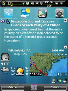
*NE USA Shown below*
 http://image.weather.com/images/maps...nw_720x486.jpg
http://image.weather.com/images/maps...sw_720x486.jpg
http://image.weather.com/images/maps...sc_720x486.jpg
http://image.weather.com/images/maps...se_720x486.jpg
http://image.weather.com/images/maps...wc_720x486.jpg
http://image.weather.com/images/maps...mw_720x486.jpg
http://image.weather.com/images/maps...ne_720x486.jpg
http://image.weather.com/images/maps...ec_720x486.jpg
http://image.weather.com/images/maps...nw_720x486.jpg
http://image.weather.com/images/maps...sw_720x486.jpg
http://image.weather.com/images/maps...sc_720x486.jpg
http://image.weather.com/images/maps...se_720x486.jpg
http://image.weather.com/images/maps...wc_720x486.jpg
http://image.weather.com/images/maps...mw_720x486.jpg
http://image.weather.com/images/maps...ne_720x486.jpg
http://image.weather.com/images/maps...ec_720x486.jpg
I think I got everything but Mountain, I couldn't figure out is two letters
(i.e., mn, mt?)

Oh well, SOL for now. Hopefully not many will need that but other than that I think I got the entire map.
*If you figure out what Mountain regions' "xx" is let me know.
You can tell what region is yours by looking at the two letters, where you see "/cur_
xx_720x486.jpg"
Enjoy...